
lettering & illustration
UK Transport Map Illustration
Client: Pearson Education
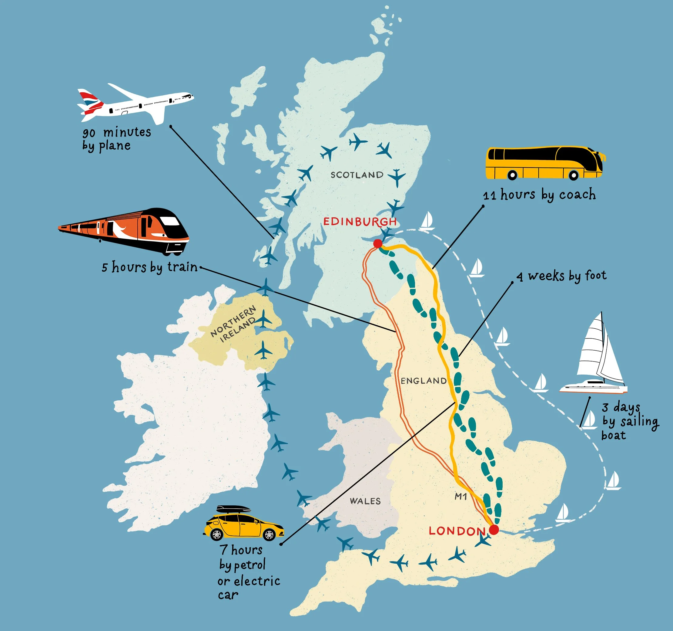
I created this illustrated map of the UK for Pearson Education for an educational publication aimed at teenage students. The brief was to show different routes between London and Edinburgh using a range of transport modes, including train, plane, coach, car, sailing boat, and walking.
The illustration combines a simplified map of the UK with custom transport icons and clearly marked routes, designed to make the information easy to follow while keeping the visual tone engaging and age-appropriate. The goal was to balance clarity, function, and personality within an educational format.